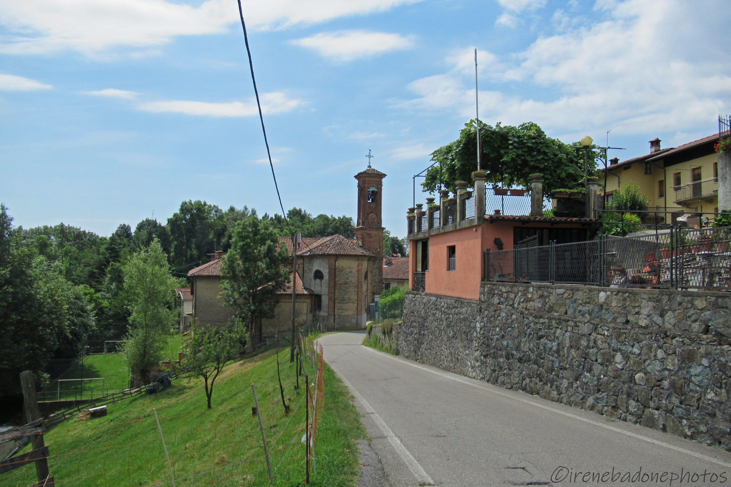
A suggestive view of the locality of Colla di Netro
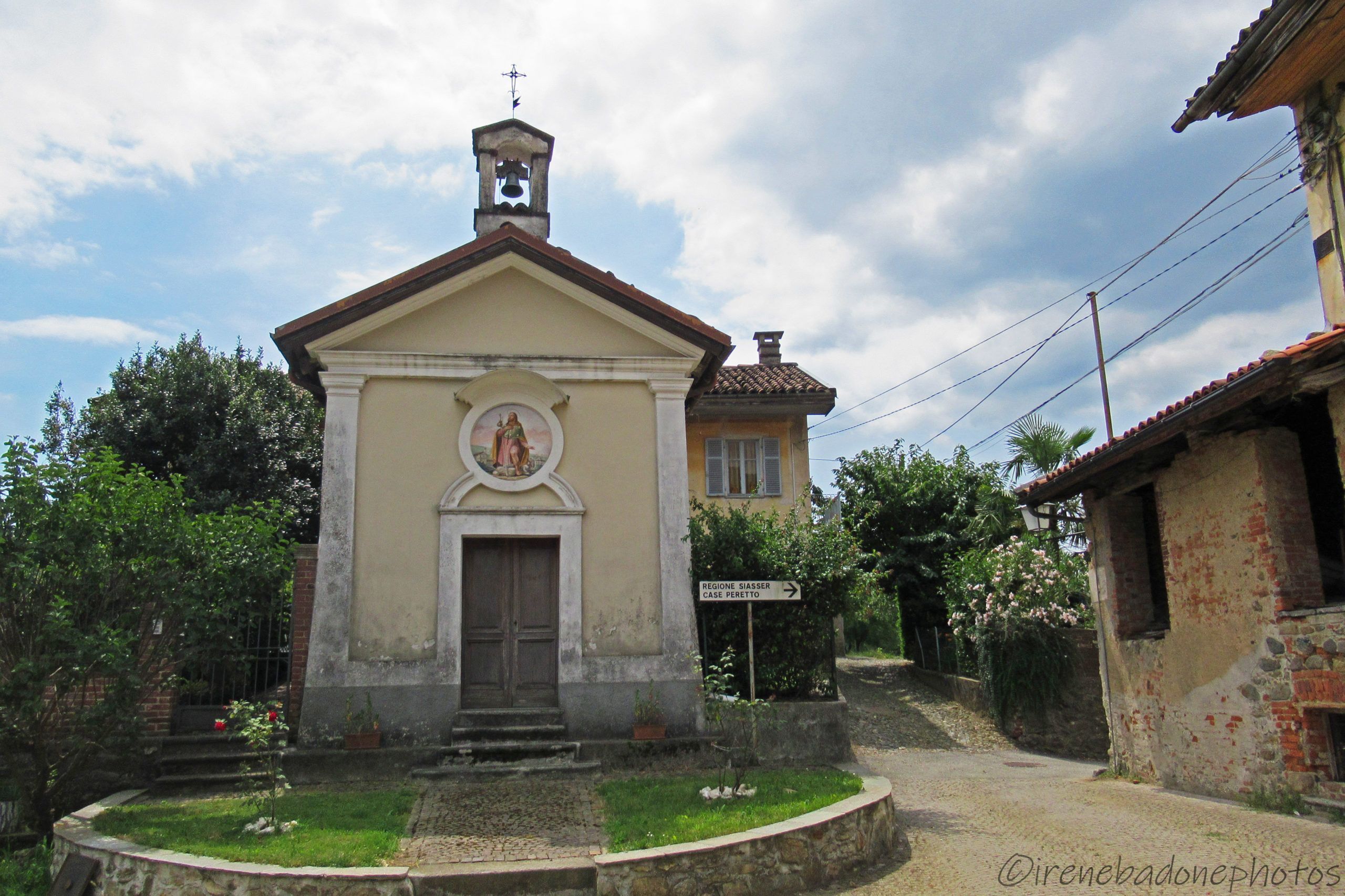
The chapel of San Rocco in the locality of Colla di Netro
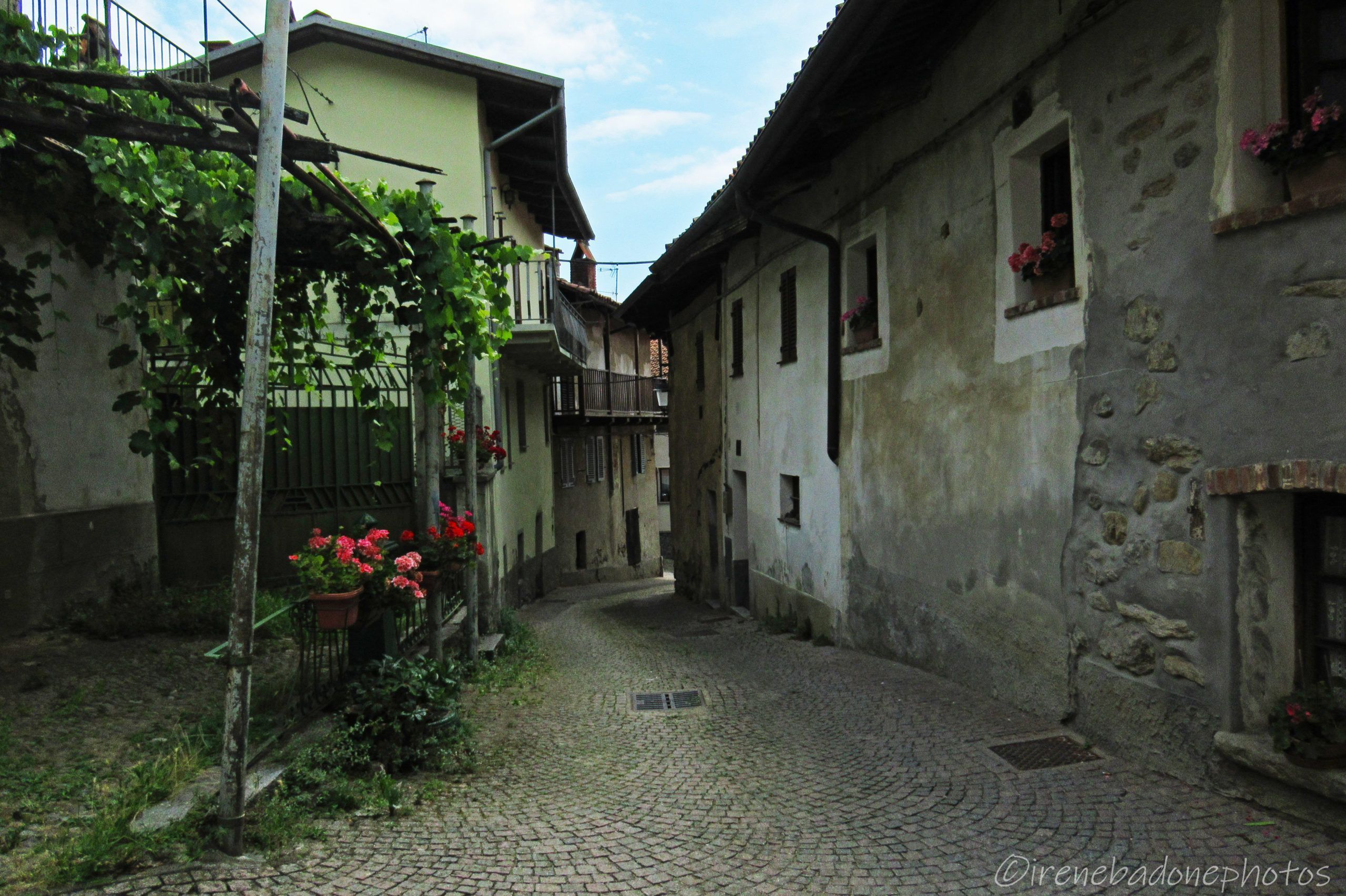
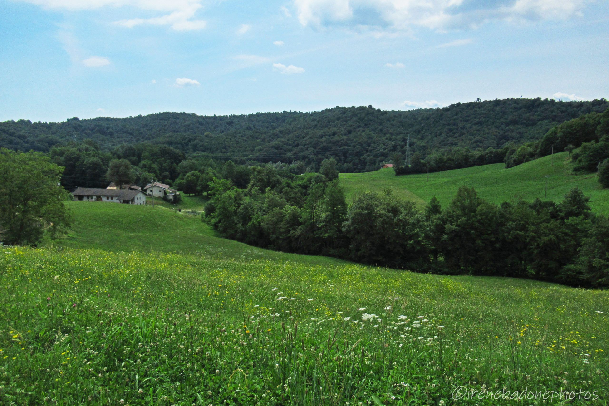
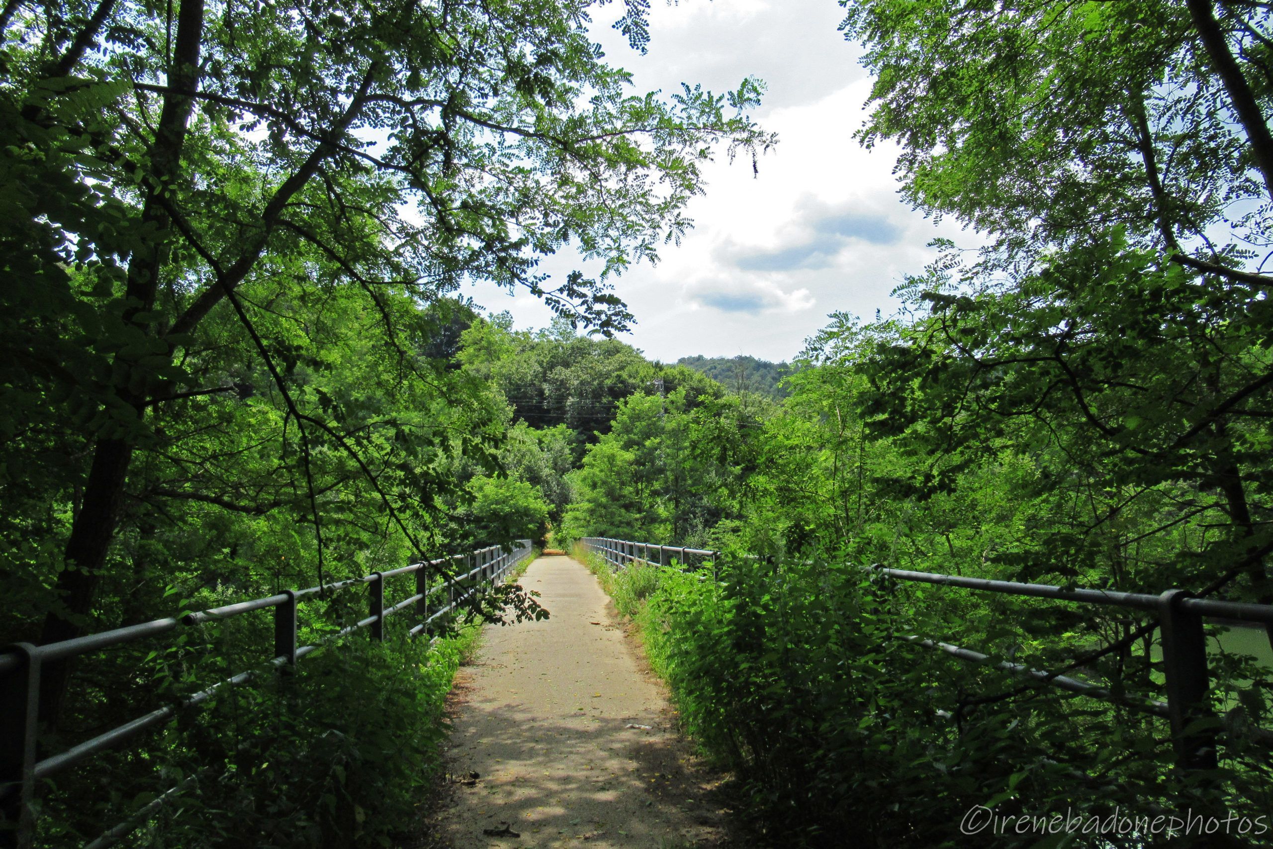
Going down among meadows and farmhouses
The bridge that crosses the lake of Ingagna
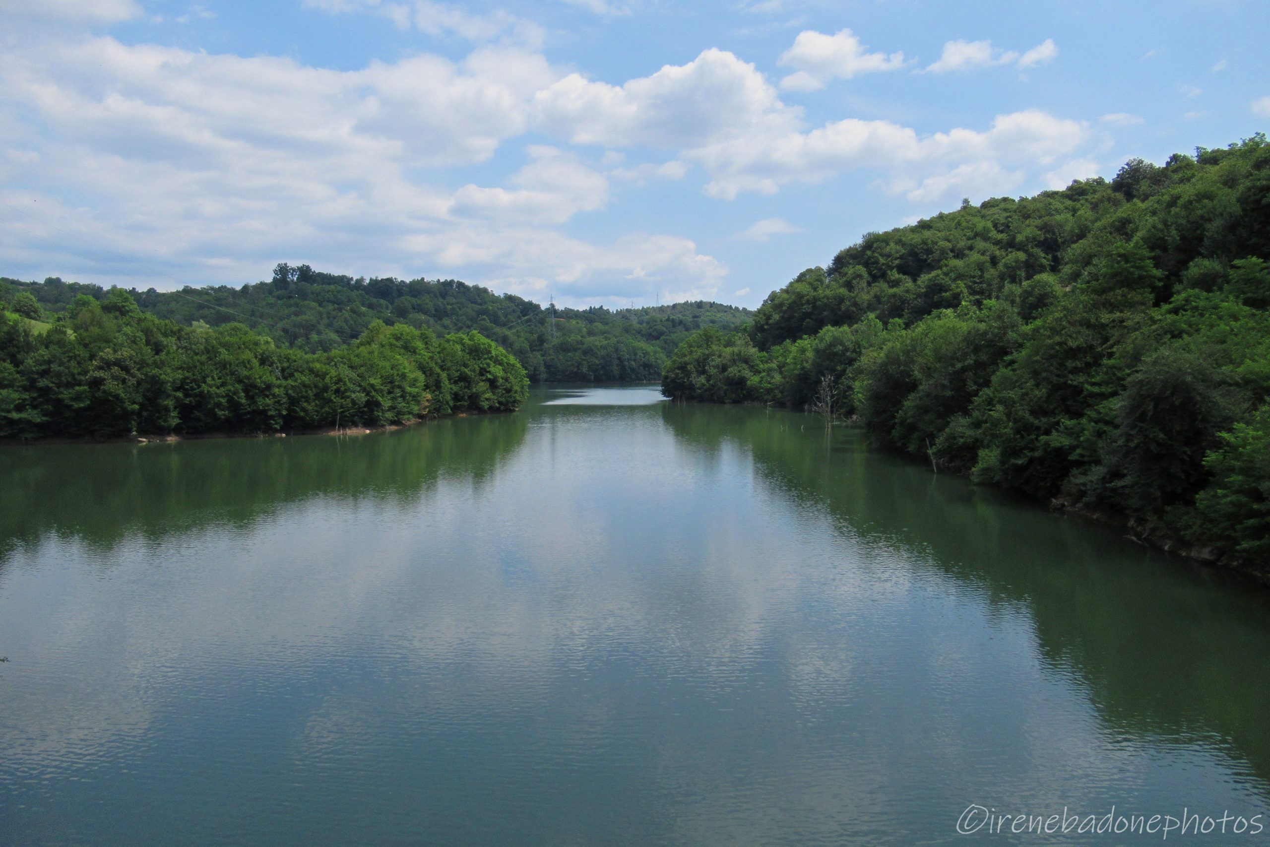
The lake towards Mongrando...
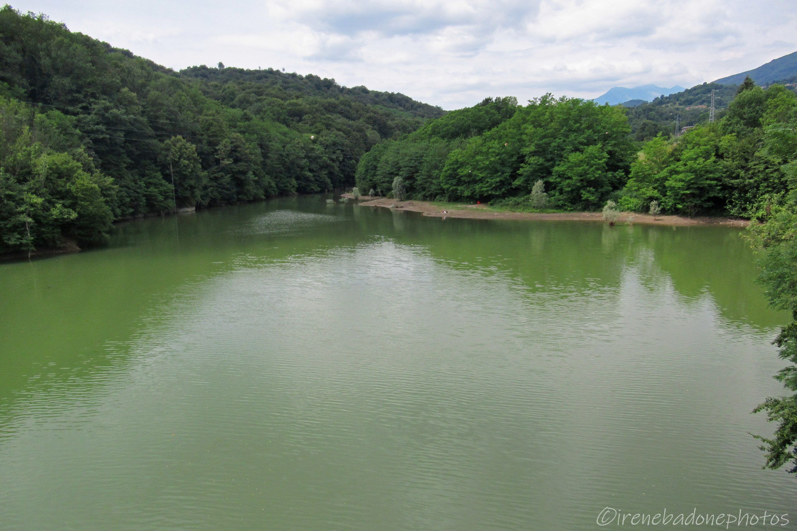
... and towards Netro
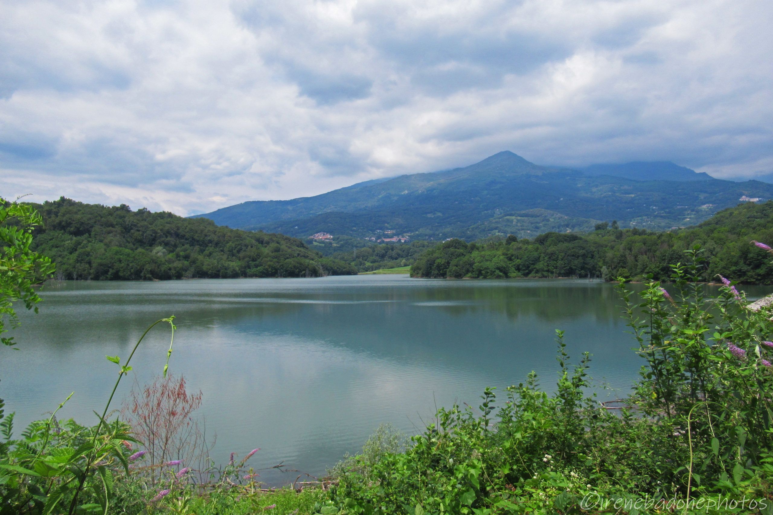
The lake and the panoramic Alps views
Arriving in the locality of Vagliumina
A suggestive view of the locality of Colla di Netro
The chapel of San Rocco in the locality of Colla di Netro
Going down among meadows and farmhouses
The bridge that crosses the lake of Ingagna
The lake towards Mongrando...
... and towards Netro
The lake and the panoramic Alps views
An abandoned bridge, a path to rediscover. Near the village of Mongrando, hidden among the dense vegetation, there’s the lake of Ingagna, an artificial invader built in the 90s amid controversy and fears. Today the dam is safe, and the lake is a destination for bathers and fishermen and for anyone who wants some peace with the panorama of the Biella Alps. The proposed route is quite challenging uphill, but still quite short and pleasant for the long descents of the return.
The Mongrando Dam was completed in the 1990s, following a project relised in the 1960s. The construction work has stopped several times, due to unforeseen events due to the unevenness of the soil and the friability of the rock. In addition, it initially aroused disapproval and fear in the citizens of Mongrando, whose houses were a few hundred meters from the imposing concrete wall and memories of the tragedy of the Vajont that occurred a few years earlier (9 October 1963). However, since its construction, the barrage has never given any problems and has well overcome some floods that have affected the Biellese over the years. Currently the dam measures 56 m high and 300 m long and forms a lake 2 km long and of the range of 8 million m3 of water that serves mainly for irrigation and for the supply of fire canadair. Every year the lake of Ingagna is the protagonist of a 10 or 23 km ring trail organized by the sports group “La Vetta Mongrando”.
To visit
Ecomuseo Fucina Morino (Mongrando)
The Morino forge dates back to 1689 and is currently the last remaining family-run in this area.
The term “forge” commonly refers to both the premises where forging is performed, and the oven itself in which the pieces of metal are heated and are then molded to obtain several different artifacts.
The water, coming from the Ingagna stream, was the driving force that through wheels and straps made the blades, moles and other machinery move. All these tools are stored inside the museum and an expert will be available to take you back in time, discovering the processing of iron in the territory of Biellese.
Visitable by reservation.
Tel. 0153 51128
340 6114854
Itinerary directions
Departure at the Mongrando Polyvalent; take Via Enrico Giovanni on the left and at the roundabout continue straight (second exit).
Always go straight on Via Monticello and at the intersection shortly after the pharmacy turn left on Via Graglia.
Stay on Via Graglia for about 2 km, even when it begins to climb considerably, thus arriving in the hamlet of Aral Grande.
Cross the group of houses and take the path referred to as “Percorso 5”.
The path goes up for a few tens of meters and then becomes flat, until it arrives on the paved road (Via Casale Molino).
Take to the left and continue for about 2.5 km.
After passing the school on the left, you reach an intersection with the SP500: take to the left and continue for about 2.3 km.
Follow the paved road that descends until you reach an intersection, then take to the right, cross the jumper and arrive in the center square of Colla di Netro.
Take Via Maestra on the left and once you arrive at the chapel of St. Rocco, continue to the right, following the paved road in the middle of the meadows.
Pass a few farmhouses, ignore the two deviations on the right and continue straight, entering the bush.
A few meters later you reach the bridge over the lake; past the bridge, take the path that remains low, on the left and that skirts the lake.
The path ends near the dam keepers’ house and you are forced to catch a trail in the middle of the forest that rises steeply to the right; after a few meters you reach the paved road.
Take right and arrive to an intersection, then turn left on Via per Netro; always proceed straight ignoring the roads on the right.
We therefore arrive in the center of Mongrando; Take Via G. Marconi on the left and continue until you get back to the roundabout, then take right (first exit) and return to the starting point.
Where to sleep
B&B le Gerle (Mongrando)
B&B il Vecchio Teatro (Mongrando)
Other activities in the area
Search for gold (Associazione Biellese Cercatori d’Oro – Zubiena)
Bike repair and rental
Lovato (Camburzano)
Some important notes
1) The goal of my itineraries is to always return to the starting point (rings) and pedal as little as possible on the asphalt. However, when this is unavoidable, I mostly choose secondary and uncongested roads. In addition, I establish the starting point in a place where it is convenient to park the car. 2) I decided to divide the Biellese into 5 main areas, depending on the geomorphology of the territory, unlike how it results in topographic maps (North-Eastern, Northwestern, Central-Eastern, South-East and South-West). 3) I have referred to some routes as “Children’s Fit”, but of course it is the responsibility of each parent to determine whether an itinerary is suitable for their child’s abilities. 4) With “Period of agility”, in the description, I refer exclusively to the presence of snow on the path, therefore not considering other variables such as rain or the presence of mosquitoes. In the “Where to Sleep” boxes I wanted to propose some alternative solutions to the typical B&B or hotel, citing facilities such as mountain huts,hostels or campsites. 5) Before you leave for any tour, read the section “In practice”!